The US state of Idaho is located in the Northwest of the USA and borders Canada to the north. Prairie and high mountains characterize the landscape of the state. Idaho is nicknamed the “Gem State” but is also known as the “Potatoe State” in the United States. In southern Idaho there are wide open plains for agricultural use. Boise (pronounced Beusi) is the capital and by far the largest city in the farming and mining state. Gold was also once mined in Idaho. In 2019, Idaho was home to approximately 1.79 million people.
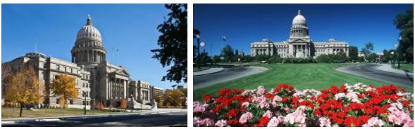
State Capitol of Idaho in the capital Boise
Idaho is shaped by the Rocky Mountains and the Snake River. The agricultural state of the USA is located on the western flank of the Rocky Mountains. The highest mountain in the country is Borah Peak at 3,859 meters. About half of Idaho is made up of forested areas.
Idaho is rich in different natural resources. Mining plays an important economic role in the US state. Other important economic sectors in Idaho are agriculture, industry and tourism. Numerous scenically valuable areas and regions in Idaho have been designated as protected areas and have thus been saved from destruction.
Cultural City of Boise
The capital of Idaho, Boise, also has a lot to offer culturally. The most famous museums in the city are the ” Boise Art Museum ” and the ” Basque Museum “. There is also a center in Boise dedicated to the worldwide protection of birds of prey called “The Peregrine Fund”.
Wild waters in Idaho
The Salmon River, which flows through Idaho, is used by sports fans from around the world for whitewater rafting and kayaking. The White Cloud Peaks region and the Sawtooth Wilderness Area are also great places to visit.
Sun Valley and Hell’s Canyon
Idaho’s Sun Valley is located between the White Cloud Peaks and the Sawtooth Wilderness Area. On the west side of Idaho are Seven Devils Mountains, also the deepest canyon in all of North America, even deeper than the Grand Canyon, Hells Canyon.
View of Boise’s governmental and financial center
Dunes and lunar landscapes
In southwest Idaho, nature wears a very different dress. There are huge sand dunes to discover in “Bruneau Dunes State Park”. The landscape in the protected area “Craters of the Moon National Monument” looks completely different. This area, located in south-central Idaho, was used by NASA astronauts as a training site for the moon landing. There are huge lava fields with tunnels and caves.
Winter sports in Idaho
In the mountainous regions of Idaho, skiing is very popular in winter. There are sixteen alpine ski areas and several hundred kilometers of groomed trails. Special snowmobile trails have also been designated. In summer, in addition to hiking and climbing, horseback riding, fishing and mountain biking are very common.
North Idaho lakes and natural treasures
In northern Idaho there are extensive softwood forests and numerous lakes. Fishing is very popular and common there. The world’s only floating golf course can be found near the town of Coeur d’Alene. East of Coeur d’Alene is a mining museum worth seeing.
Twin Peaks Castle Peak and Merriam Peak – White Cloud Mountains in Idaho
In Idaho there is a section of Yellowstone National Park with numerous hot springs. In addition to the Yellowstone National Park, Idaho has a natural highlight worth seeing with the ” Shoshone Falls ” (waterfalls) on the Snake River. The Shoshone Indian Ice Caves are worth seeing, as is historic Fort Hall.
Agriculture, Livestock and the Consequences
To the south is a wide, relatively flat plain. The Snake River waters this region of Idaho. The cultivation of potatoes is very pronounced there on huge arable land. Descendants mainly from Europe and Germanynative immigrants run the farms there. However, lack of water in the region is causing increasing problems. Excessive amounts of water are diverted from the Snake River by agriculture. In hot summers, the Snake River sometimes dries up, with devastating effects on the flora and fauna of the water-bearing lifeline. An example is Pacific salmon. Due to low water levels and the resulting much too warm water in the Snake River, the salmon hardly ever reach their spawning waters in Idaho. Cattle farming is very common in the country. Areas that cannot be used for agriculture are usually grazed by large flocks of sheep.
Attractions in Idaho
Shoshone Falls
Hell’s Canyon
Dworshak Dam
Boise Idaho Temple
Idaho Falls Temple
Boise National Forest
Craters of the Moon National Monument
Lewis and Clark Historic Trail
Nez Perce Historical Park
American Falls Reservoir
Corkscrew
Bald Mountain
Twin Falls
City of Rocks
Sun Valley
Bear Lake
Clearwater Mountains
Salmon River
Snake River
Bruneau Dunes
Yellowstone National Park
Largest cities in Idaho
Boise
Nampa
Meridian
Idaho Falls
Pocatello
Caldwell
Coeur d’Alene
Twin Falls
Lewiston
Post Falls
See Countryaah for more cities in the state of Idaho.
The largest rivers in Idaho
Salmon River
Clearwater River
Snake River
Idaho map
The map of Idaho in the Northwest of the USA. The map shows the neighboring states, the largest cities in the country, the rivers and lakes as well as the courses of the highways and the most important roads in the state. The area of Idaho, assigned to the western states of the USA, is 216,446 km². The capital of the country is Boise. About 1.79 million people currently live in the US state of Idaho.